Fifth Avenue runs from NW Sixth to NW 13th Street north of University Avenue, with the University Heights North historic district. ZIP code 32601.
Last checked Oct. 8, 2026. Sources: the City of Gainesville’s neighborhood layer, address points, historic preservation page and parks layer; Alachua County Public Schools’ 2026-27 zone maps; the Florida Department of Education’s 2026 school grades; Zillow Research; the Regional Transit System’s fall 2026 schedule data; and OpenStreetMap.
Fifth Avenue is the neighborhood between downtown Gainesville and the University of Florida, north of West University Avenue. The city’s land planning map calls it Fifth Ave; its historic preservation plan calls it the NW Fifth Avenue neighborhood. Its southern blocks hold the University Heights Historic District-North, one of the city’s five local historic districts.
What this means for you
- Zoned high school: Gainesville High for every address, a B school in Florida’s 2026 grades. Check yours on the district’s Find My School page.
- Home value: $261,658 in ZIP code 32601 in August 2026, according to the Zillow Home Value Index.
- Nearest I-75 exit: exit 384, Archer Road, about 4.6 miles by road.
Part of our Gainesville neighborhoods guide.
Where it is
The city’s neighborhood layer draws Fifth Avenue as about 163 acres bounded by West University Avenue on the south, Northwest 13th Street on the west, Northwest Sixth Street on the east and Northwest Eighth Avenue on the north. The University of Florida campus is across University Avenue to the southwest, and the Pleasant Street neighborhood is across Sixth Street to the east.
The city’s address data lists 1,656 addresses inside that line, 1,449 of them homes. About seven in 10 homes carry an apartment or unit number, the highest share of the neighborhoods in our guide outside downtown. Every address is in ZIP code 32601.
History and historic districts
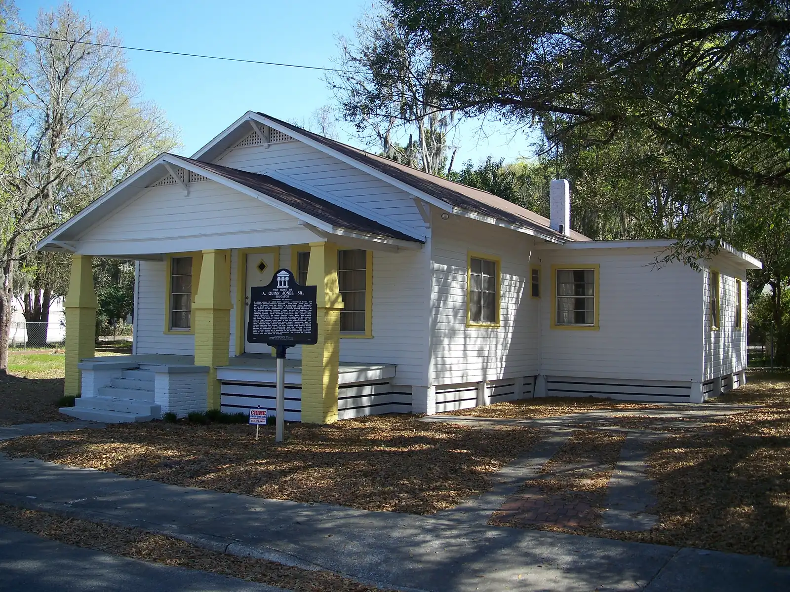
The city’s historic preservation element (PDF) says city staff resurveyed the NW Fifth Avenue neighborhood in the spring of 1995 and counted about 300 dwellings, about 203 of them contributing historic buildings. A 2007 survey for the Community Redevelopment Agency identified four resource groups: a section of railroad and its depot, an African Methodist Episcopal church complex, the historic Lincoln High School and a commerce center. It found 256 resources that could contribute to a possible NW Fifth Avenue Historic District, which the plan lists as a potential district. The same plan, dated Aug. 4, 2011, listed the A. Quinn Jones House on Northwest Seventh Avenue as pending for the city’s Local Register of Historic Places.
The University Heights Historic District-North, approved by the City Commission on Jan. 14, 2002, lies inside the southern part of the neighborhood on the city’s district map. Its companion, University Heights Historic District-South, is across University Avenue. The city has maps of the north district (PDF) and the south district (PDF). Design review in a local historic district follows Section 30-112 of the city’s Land Development Code; questions go to the Planning Division, 352-334-5023.
Schools
How the neighborhood’s homes fall in Alachua County Public Schools’ attendance zones for the 2026-27 school year, with each school’s 2026 grade from the Florida Department of Education:
| Level | School | Share of homes | 2026 grade |
|---|---|---|---|
| Elementary | Carolyn Beatrice Parker Elementary, 1912 NW Fifth Ave. (report card) | 100% | B (54%) |
| Middle | Abraham Lincoln Middle, 1001 SE 12th St. (report card) | 100% | A (65%) |
| High | Gainesville High, 1900 NW 13th St. (report card) | 100% | B (64%) |
The percentage after each grade is the share of possible points the school earned. The district drew new zones for 2026-27, so check an address on its Find My School page. More in our schools guide.
Home values
The typical home value in ZIP code 32601 was $261,658 in August 2026, up 0.4% from $260,732 in August 2025, according to the Zillow Home Value Index. The index is a modeled typical value for the middle third of homes, single-family homes and condos together, not a sale price, and it covers the whole ZIP code. Zillow’s figure for the city as a whole was $295,760, down 1.2%. More in our home prices guide.
Parks and trails
From the city’s parks layer, all inside the neighborhood unless noted:
- Sharmie Ffar Park, 321 NW 10th St., with a playground, picnic tables and a basketball court, next to the Wilhelmina Johnson Resource Center at the same address.
- Northwest Fifth Avenue Park (Seminary Tot Lot), 1007 NW Fifth Ave., with a playground.
- Dolliree Bowens Tot Lot, 820 NW Fourth Ave., with a playground.
- Kiwanis Girl Scout Park, 810 NW Eighth St., at the north edge, with a playground and picnic tables.
More in our parks and trails guide.
Getting around
- I-75: exit 384, Archer Road, about 4.6 miles by road, or exit 382, Williston Road, about 5.4 miles.
- City Hall: about 1.1 miles.
- Gainesville Regional Airport: about 5.6 miles.
- These are distances on the OpenStreetMap road network, measured with the OSRM routing engine, not drive times.
- Bus: RTS routes 5, 6, 8, 10, 13 and 55 stop in or at the edge of the neighborhood, in the RTS fall 2026 schedule data.
More in our getting around guide.
Groceries and everyday stores
From OpenStreetMap:
- Publix, 203 NW 13th St., inside the neighborhood on its west edge
- Chun Ching Market, 418 NW Eighth Ave., just east of the neighborhood
- CVS Pharmacy, on SW 13th Street, about a fifth of a mile southwest
- Wise’s Pharmacy, 708 SW Fourth Ave., about a quarter of a mile southeast
How we drew this area
This page uses the Fifth Ave outline in the City of Gainesville’s neighborhood layer, which the city says is not an official boundary. Address counts come from the city’s address points inside it, matched to the district’s 2026-27 zone maps on Oct. 8, 2026. Store and road locations are © OpenStreetMap contributors.
Frequently asked questions
Where is the Fifth Avenue neighborhood in Gainesville?
Between downtown and the University of Florida. The city’s neighborhood map draws it from West University Avenue north to Northwest Eighth Avenue, between Northwest Sixth Street and Northwest 13th Street, all in ZIP code 32601.
Is University Heights in the Fifth Avenue neighborhood?
The University Heights Historic District-North is. On the city’s maps it lies inside the southern part of the Fifth Avenue neighborhood. University Heights Historic District-South is across University Avenue. The City Commission approved both on Jan. 14, 2002.
What schools serve the Fifth Avenue neighborhood?
Every home is zoned for Parker Elementary, Lincoln Middle and Gainesville High on the district’s 2026-27 zone maps. In Florida’s 2026 grades Parker earned a B, Lincoln an A and Gainesville High a B.
Which bus routes serve the Fifth Avenue neighborhood?
RTS routes 5, 6, 8, 10, 13 and 55 stop in or at the edge of the neighborhood in the RTS fall 2026 schedule data.
Have your say