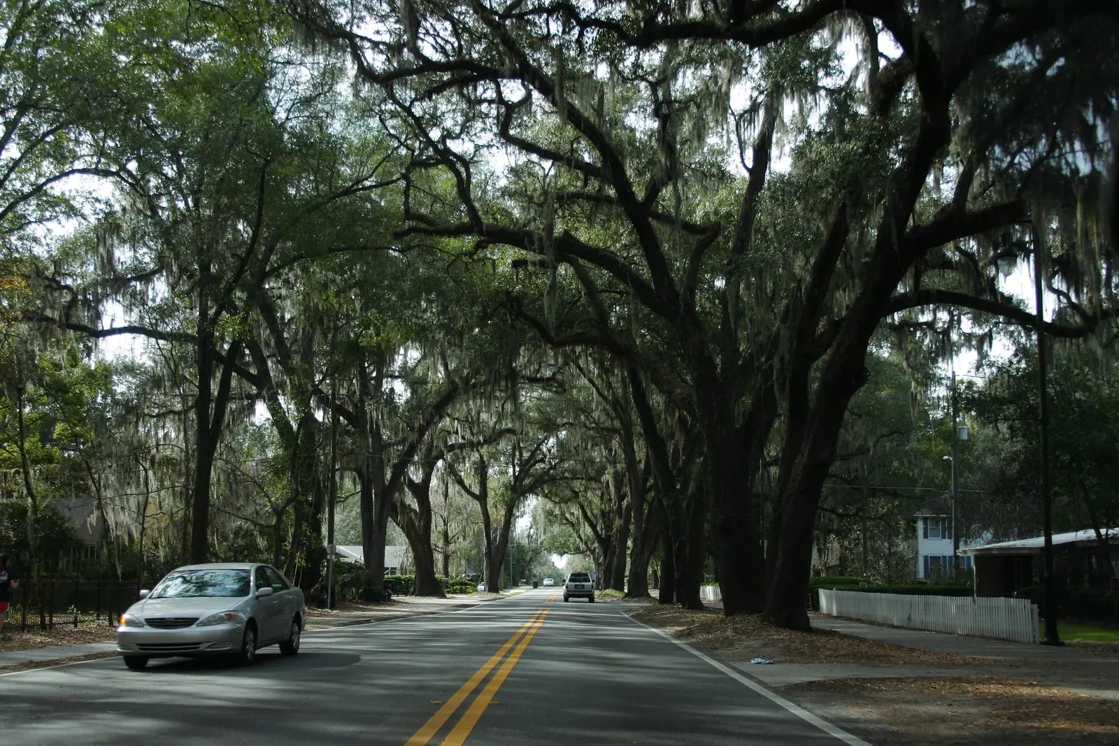
10 Gainesville neighborhoods from Duckpond to Suburban Heights: ZIP codes, 2026-27 school zones and grades, and August 2026 Zillow home values.
Last checked Oct. 8, 2026. Sources: the City of Gainesville’s neighborhood layer, address points, city limits and historic preservation page; Alachua County Public Schools’ 2026-27 zone maps; the Florida Department of Education’s 2026 school grades; Zillow Research; the Census Bureau; and OpenStreetMap.
Gainesville is a city of 145,702 people, according to the Census Bureau’s 2020-2024 American Community Survey, and covers about 64 square miles of land in the Census Bureau’s 2024 place file. The University of Florida campus sits southwest of downtown. Main Street and University Avenue cross downtown and split the street grid into its northwest, northeast, southwest and southeast quarters, so an address such as 1900 NW 13th St. tells you roughly where it is. North-south, the main roads are Main Street, 13th Street (U.S. 441), 34th Street (State Road 121) and 43rd Street; east-west, they are University Avenue (State Road 26), Northwest 23rd Avenue, Northwest 39th Avenue (State Road 222), Archer Road and Newberry Road. I-75 runs down the west side of town, with exits 382 (Williston Road), 384 (Archer Road), 387 (Newberry Road) and 390 (Northwest 39th Avenue) on OpenStreetMap.
Three things to know before you look at a listing:
- The mailing address is not the city. The city’s own address layer lists 10,903 addresses just outside the city limits, in unincorporated Alachua County, most of them in ZIP codes 32607, 32608 and 32606 on the west and southwest side. Homes there pay county taxes, not city taxes; see our property taxes guide.
- Nine ZIP codes cover most of the city. Of about 79,100 addresses inside the city limits, 20% are in 32608, 18% in 32601, 16% in 32607, 15% in 32605, 10% in 32609, 7% in 32653, 5% in 32641 and 4% each in 32603 and 32606. The campus is 32611.
- School zones changed this year and do not follow neighborhood lines. Alachua County Public Schools drew new attendance zones for 2026-27. Of the homes inside the city, 48% are zoned for Gainesville High, 46% for Eastside High, 4% for Buchholz High and 1% for Santa Fe High. Check one address on the district’s Find My School page.
How the city maps its neighborhoods
The city’s Planning Department publishes a neighborhood layer with 115 named outlines, from Duckpond and Pleasant Street to Northwood Pines and Sutter’s Landing. The city says the outlines are not official boundaries; many match a neighborhood association registered with the Planning Department, and some do not have one. About 40% of the homes inside the city fall inside one of the outlines. Most of the rest, including much of the apartment-heavy southwest around Archer Road, are not in any named neighborhood on the map.
The city also has five local historic districts, which protect more than 1,500 historic buildings, according to its historic preservation page: the Northeast Residential district (1985), the Southeast district (1989), Pleasant Street (1991) and University Heights North and South (both 2002). The dates come from the city’s historic preservation element (PDF).
The areas at a glance
Home values are the Zillow Home Value Index for the ZIP code that holds most of each area, in August 2026. The index is a modeled typical value for the middle third of homes, not a sale price, and it covers the whole ZIP code. High school zones are from the district’s 2026-27 maps.
| Area | ZIP code | Zoned high school | Typical home value, ZIP code | Guide |
|---|---|---|---|---|
| Downtown | 32601 | Eastside High (76% of homes), Gainesville High (24%) | $261,658 | Downtown |
| Duckpond | 32601 | Eastside High | $261,658 | Duckpond |
| Pleasant Street | 32601 | Gainesville High | $261,658 | Pleasant Street |
| Fifth Avenue | 32601 | Gainesville High | $261,658 | Fifth Avenue |
| Porters | 32601 | Gainesville High | $261,658 | Porters |
| University Park | 32603 | Gainesville High | $419,262 | University Park |
| Duval | 32641 | Eastside High | $180,141 | Duval |
| Stephen Foster | 32609 | Gainesville High | $220,470 | Stephen Foster |
| Northwood | 32605 | Gainesville High | $302,487 | Northwood |
| Suburban Heights | 32605 | Buchholz High | $302,487 | Suburban Heights |
Zillow’s figure for the city as a whole was $295,760, down 1.2% on the year. In Florida’s 2026 school grades, Buchholz High earned an A with 67% of possible points, Gainesville High a B with 64% and Eastside High a C with 58%, according to the Florida Department of Education. More in our home prices guide and schools guide.
Map of the areas
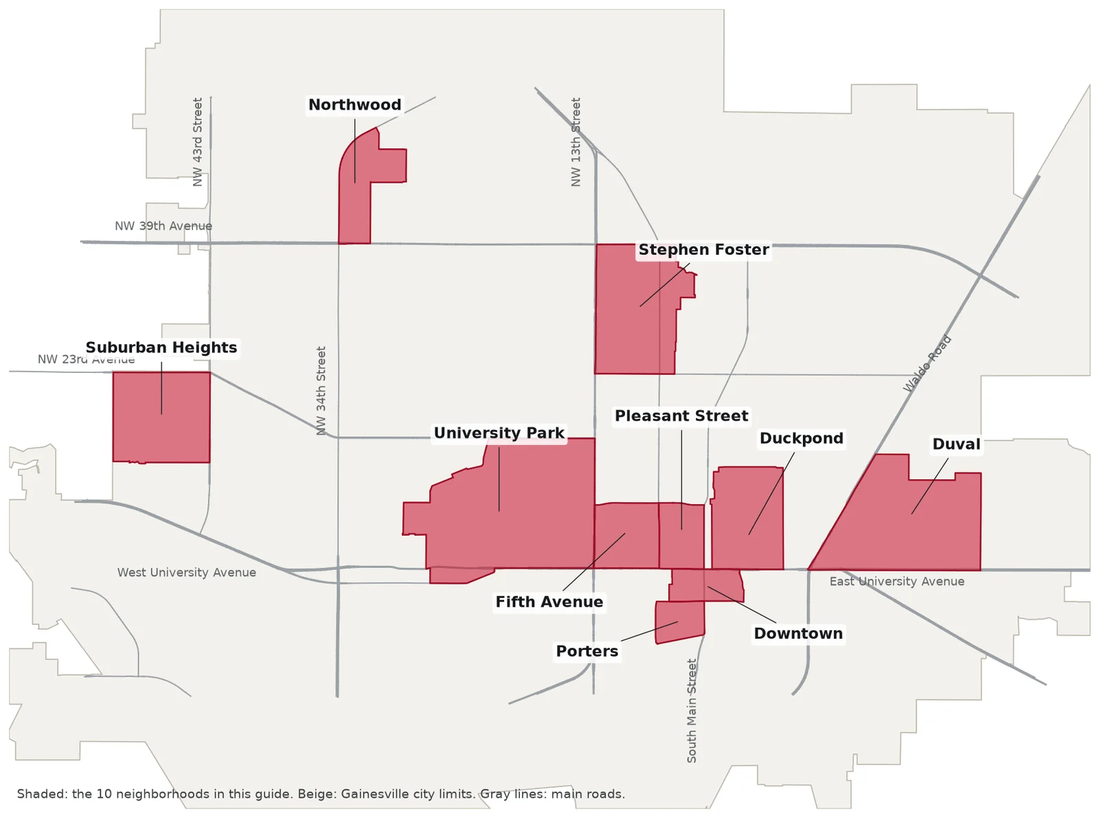
Map by Gainesville Journal. City limits and neighborhood outlines from the City of Gainesville; roads © OpenStreetMap contributors.
The areas
Downtown. About 89 acres south of University Avenue around Main Street, with Bo Diddley Plaza and the Hippodrome. Almost all of its 349 homes are apartments or condominiums.
Duckpond. The neighborhood northeast of downtown, most of it the Northeast Residential Historic District, approved in 1985. It holds City Hall and the Thomas Center.
Pleasant Street. The blocks northwest of downtown between Sixth Street and Main Street, with the Pleasant Street Historic District at their center.
Fifth Avenue. Between Sixth and 13th streets north of University Avenue, with the University Heights North historic district and the A. Quinn Jones House.
Porters. A small neighborhood of about 220 homes between Southwest Fourth Avenue and Depot Avenue, across from Depot Park.
University Park. The largest area in this guide, about 3,400 homes north of the University of Florida, including College Park.
Duval. About 1,340 homes in east Gainesville between Waldo Road and Fred Cone Park, with the 26-acre Duval Park. The closest area in this guide to the airport.
Stephen Foster. North-central Gainesville between Northwest 23rd and 39th avenues, including the Suncrest bungalows, with supermarkets along 13th Street.
Northwood. About 400 single-family homes north of Northwest 39th Avenue and east of Northwest 34th Street.
Suburban Heights. About 510 single-family homes between Northwest 43rd and 55th streets, the only area in this guide zoned for Buchholz High.
Two more named places on the city’s maps: the Southeast Historic District, east of downtown along East University Avenue and the blocks south of it, which includes the Matheson House at 528 SE First Ave.; and University Heights Historic District-South, across University Avenue from the Fifth Avenue neighborhood. Neither falls inside a neighborhood outline on the city’s layer, so they have no page of their own here.
Comparing Gainesville with nearby cities? See Gainesville vs. Alachua vs. Newberry vs. High Springs. For parks, buses and taxes citywide, see our parks and trails, getting around and moving to Gainesville guides.
How we built this
The areas come from the City of Gainesville’s neighborhood layer, the land planning map the Planning Department keeps, checked against the city’s historic district layer and the neighborhood names on OpenStreetMap. We picked 10 that the city names, spread across the city, and drew each one exactly as the city’s outline draws it. We counted homes with the city’s address points, assigned them to Alachua County Public Schools’ 2026-27 attendance zones, and took ZIP codes from the same address data. Distances are measured on the OpenStreetMap road network with the OSRM routing engine, and bus routes come from the Regional Transit System’s fall 2026 schedule data. We do not rank the areas or say which is better for anyone.
Frequently asked questions
What are the neighborhoods in Gainesville, Florida?
The city’s Planning Department maps 115 named neighborhoods. Our guide covers 10 of them: Downtown, Duckpond, Pleasant Street, Fifth Avenue, Porters, University Park, Duval, Stephen Foster, Northwood and Suburban Heights.
What ZIP codes are in Gainesville city limits?
Of about 79,100 addresses inside the city in its address data, 20% are in 32608, 18% in 32601, 16% in 32607, 15% in 32605, 10% in 32609, 7% in 32653, 5% in 32641 and 4% each in 32603 and 32606. The University of Florida campus is 32611.
What high school is Gainesville zoned for?
It depends on the address. On Alachua County Public Schools’ 2026-27 zone maps, 48% of homes inside the city are zoned for Gainesville High, 46% for Eastside High, 4% for Buchholz High and 1% for Santa Fe High.
Is a Gainesville mailing address always in the city?
No. The city’s own address layer lists 10,903 addresses outside the city limits, in unincorporated Alachua County, most of them in ZIP codes 32607, 32608 and 32606. The Property Appraiser’s parcel search shows which city, if any, a parcel is in.
Have your say